Mt. Shasta
Hiking Mt. Shasta is something I never thought I would do twice. To quote myself the last time I did it: "Sometimes I wonder why people, myself included, subject themselves to such pain and misery".
It started off pretty ominously.
The problem with this is that we are hiking up a hill with a 40+ lb pack on our backs...above the tree line. This means there is no shade, so a high of 99 is BRUTAL. To top that off, part of the hike is through snow and the last time we did this, the reflection of the sun off the snow gave me a wicked sunburn on my lips and under my chin. And the last time we hiked it, it even snowed a little! So this was going to be hard.
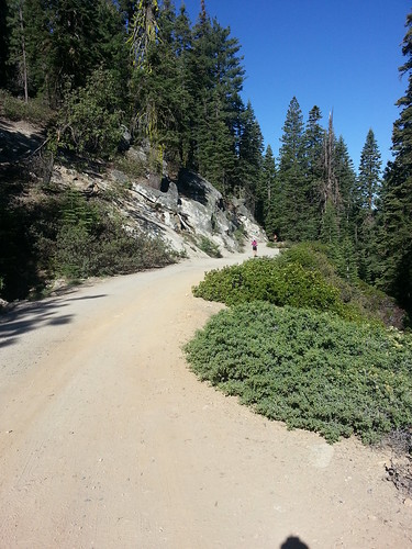
6,915 ft* / 0 miles / Bunny Flat: The hike starts just above Shasta City at the Bunny Flat trailhead. After grabbing our poo bags, we started up the trail. Oh, you want to know what I mean by "poo bags"? Let's just say that you have to carry EVERYTHING out; nothing can be left behind. Need I say more? My mom joined us for the first two miles, which ends at Horse Camp.
 |
| Ready to go |
7,898 ft / 2 miles / Horse Camp: Horse camp is the first place you can camp, if you like, and is the last place to get running water. At Horse Camp there is a natural spring where the water comes right from the ground and you can fill up to your heart's content. It is delicious. After this, all water will be from melted snow. Horse Camp is also the last place with a real toilet. After this, business will NOT be as usual. At Horse Camp, we filled up with water, used the facilities, ate a Snickers bar (man, I have not had one of those in a long time!) and said goodbye to Mom.
 |
| Below Standstill Hill |
10,430 ft / 4 miles / Helen Lake: From there, it is a semi-flat slog for about .75 miles on a rock path called the Olberman Causeway, which is named after one of the caretakers, who made a 950 yard long rock path from Horse Camp to the bottom of the steep hill. Once we crossed the causeway, the hill went up and was mostly scree, which is a bunch of loose rocks, and is really hard to hike/climb because it's very slippery. After the scree hill came a snowy one, aptly named Standstill Hill, as you are starting to feel the elevation, plus you can only take one tiny step at a time so that you don't fall.
 |
| Helen Lake: Trying to stay out of the sun. |
At the top of Standstill hill is Helen Lake, which is where we camped the first night. It's good to camp at a higher elevation in order to get acclimated for the next day. However, we arrived pretty early, as we had started pretty early in the morning in order to avoid the sun. We got our camp set up and then pretty much ate and stayed in the tent reading and talking in order to stay out of the sun. Unfortunately, it is summer and the sun stays out late! It finally went over the mountain around 7, so we had dinner and then went to bed.
The next morning we got up at 2, ate breakfast and started up the hill. It's best to start early for a few reasons. First, you want the snow to be icy. This facilitates crampon use as well as helping you to get down the mountain later, which you do by sliding on your butt. If it is too slushy, you will not slide very well and you will get really wet to boot. Also, it's hot during the day; you want to minimize the time you spend in the sun as much as you can.
12,555 ft / 5.5 miles / Red Banks: The first mile and a half was done in the dark and was hard. It took us about an three hours, including breaks, and we gained about 2,000 ft in elevation. We were wearing winter clothes and I was sweating inside my coat but it was too cold to take it off. The going was slow. The hill was straight up. It was icy and walking with crampons up a 45 degree angle (est) is hard. In this period, we passed the Heart and got to the bottom of the Red Banks.
13,773 ft / 6.25 miles / Misery Hill: An hour and 45 minutes later, we reached the top of Misery hill. To get there, we had to go through a chute in the Red Banks. Usually you can walk around the Red Banks, which means more mileage, but it's less steep. However, it does include a hill termed Heart Attack Hill, which we avoided by going straight up the chute. However, the chute was a heart attack and a stroke, so we didn't really get off easy. The chute made Misery Hill, which is usually deadly, seem pretty tame. We took a break between the chute and Misery Hill and at this point the altitude was definitely affecting us. Also, the sun was out and it was strong. I was pretty ready to be done, but knowing that I only had about 1,000 ft left (from the bottom of Misery) kept me going. I was not about to quit now!
 |
| Bottom of Misery Hill: Starting to feel it. |
14,129 ft / 7 miles / The Summit: Like a marathon, the last little bit was the hardest. There were rocks, which are no good with crampons on, and I had a headache that wouldn't quit. Also, altitude makes you feel like such a weakling! My whole body was unresponsive and my brain was dysfunctional. I wasn't hungry, which really made me realize that the altitude was affecting me, because we had just hiked for five hours and I should be famished. I was pretty happy to make it to the summit. Once we got there, We we didn't hang out long; we took the obligatory photos and got the heck out of there. At this point, it was about 8 a.m.
It's amazing; as soon as you start to head downhill, you start to feel better. It's like immediate relief. We headed down a few feet, ate a snack and then hiked back down Misery Hill and through the Red Rock chute (which was NOT any easier going down). This is where the fun began. We took off our crampons and got our ice axe at the ready and glissaded down the snow on our butts. The same part that took us about an hour and a half to climb up took us about 15 minutes to slide down.
We finished our slide at Helen Lake, where we broke camp and boiled a little more snow for water before heading back down to Horse Camp. We didn't really have enough water, which was really stupid on our part. We had boiled a bunch the night before, but we ended up drinking more than expected during the night and so we didn't have enough left in camp for the last leg down. So we made pretty good time down to Horse Camp because we were jonesing for that natural spring water!
We got back to Bunny Flat at 2 p.m. I was hot and tired and thirsty! We went back to the hotel and took a shower and tried really hard not to fall asleep before dinner (it didn't work). We finally went to dinner where I drank a bunch of beverages and ate like a horse before going back home and going to bed around 7 p.m.
Verdict? Things we did well: We brought the perfect amount of food. At first I was worried it wasn't enough, but the second day with the high altitude really doesn't warrant a lot of food. We ended up having some left over but not a whole lot. Starting early is a great idea, although it does leave a lot of time in camp the first day. Things I would do differently: Boil more water! Bring a tarp or something to make shade during the day. As much as I like to make fun of them, those ski pole walking sticks would probably be pretty handy.
We actually saw a few people who did it all in one day. They started at Bunny Flat around 10 pm and hiked up to the summit and back in one day and got back around the same time (or earlier) than we did. I think this may be better due to the fact that you are not carrying your tent etc with you, so your load is much lighter. However, knowing how tired I was on Sunday after four miles less (and 4,000 ft gain less) than them, I am not sure I would be able to do it in one go.
*All elevations shown are from my / Broski's Garmin recordings.
Have you ever done a multi-day hiking trip? Have you ever been so tired you went to bed at 7 p.m.? What's the earliest you've gotten up in the morning for an event?


